

January 22, 2024 Feldman Geospatial’s Reality Capture: Reenergizing the Historic Space at the Charlestown Pumping Station
Guest blogger Stephen Wilkes, Chief Innovation Officer and Vice President of Feldman Geospatial, provides expert insight into the recent survey and scan they conducted at the Charlestown Pumping Station. Feldman Geospatial provides the data and expertise that construction managers, engineers, and developers need to actualize their most ambitious site plans. Follow along for an exclusive look inside the Charlestown Pumping Station.
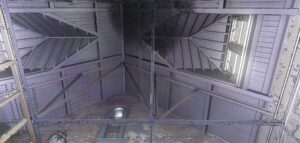
Sitting between the Mystic River and Alford Street bridge, it can be easy for the public traveling to and from Charlestown and Everett to miss this small slice of the area’s historic infrastructure. Built in 1895, the Charlestown Pumping Station is still owned by the MWRA, although it has been mostly disused since the 1990’s following the development of more modern treatment stations in the area.
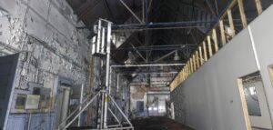
An initiative between the City of Everett and Historic Boston Incorporated looks to reinvigorate the pumping station. Feldman Geospatial was brought in to perform a comprehensive Reality Capture survey to document the existing conditions of this distressed building.
With a structure in such a challenging condition, it was key to provide all the stakeholders with comprehensive and accurate 3D information from which they could begin to craft potential ideas for the building’s reinvigorated future. Being able to connect people with the building in a safe and easily accessible manner would be paramount.
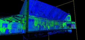
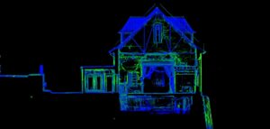
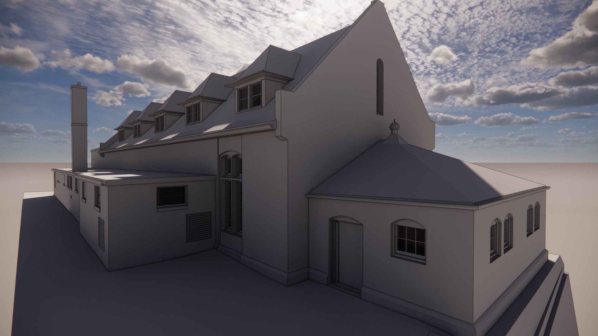
Using a combination of the latest laser scanners and forward-thinking integrated survey control, Feldman Geospatial was able to capture the exterior, interior, and even parts of the submerged basement of the pump station. All the separate scanning locations were then combined to form one holistic survey-grade point cloud. This point cloud is a collection of millions of individual measurements tightly related to each other, from the tip of the exterior roof to the water line of the interior basement.
Having generated these millions of individual measurements, Feldman Geospatial’s 3D team then developed the point cloud of the pump station and surrounds into a Building Information Model (BIM), a virtual 3D representation of the structure and scan data geared towards collaborative development and planning by design teams. The BIM, developed in Autodesk’s Revit platform, allows for design teams to drive new end usage ideas, and integrate directly with the existing building conditions, generating plans, sections, and elevations, or combining other 3D models for feasibility and coordination.
By providing this accurate virtual resource as a platform for engaging with the revitalization, Historic Boston’s team can continue to connect specialists and consultants with the Charlestown Pump Station, and create a vision for highlighting this buildings potential in the local landscape once again.