


31 Oct 2023 How to use MapJunction to unearth your neighborhood history
Have you ever wondered what your neighborhood looked like 10, 20, 50, or even 100 years ago?
Here at HBI, we often find ourselves employing a number of useful tools when we’re researching a historic site. We encourage you to take another look at “Rooting Out the History of Your Home: Your DIY Guide to Research” that guest blogger, historian, and preservationist Sally Zimmerman wrote that details how to navigate MACRIS Maps to uncover the history of your home.
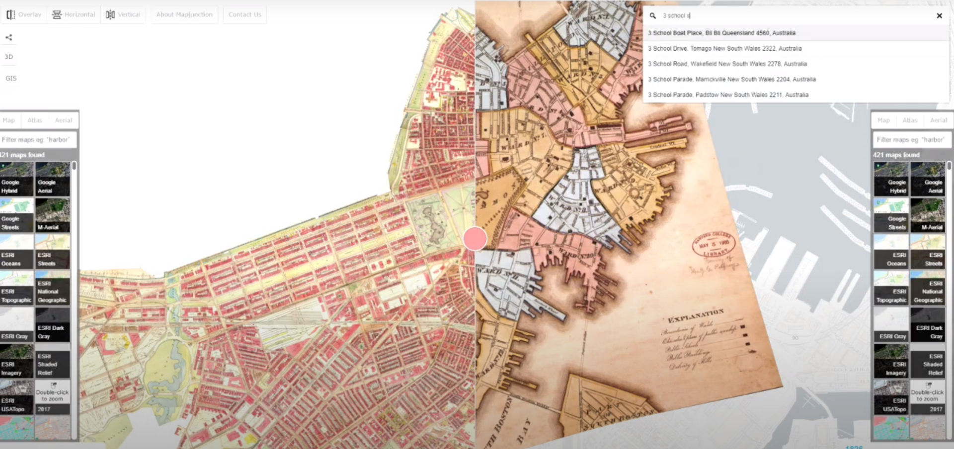
Today we’re going to be giving a tutorial on how to use the website MapJunction in order to see your neighborhood, town, city, or state throughout the last two centuries! This site pulls the historical maps that are applicable to the area or region you’ve focused on and works with Google Maps to overlay them as accurately as possible.
The site was created in 1999 by Bill Warner when he was working with the City of Boston to create a video of the city in light of the upcoming millennium. After learning that Boston was built upon about two-thirds of filled-in land, Warner sought to build an online system that would allow historic maps to be overlaid on the current geography to show Boston over the centuries. Warner worked with engineer, Greg Cockroft, to create this interactive mapping system using Java applets, ultimately creating a tool that could process an entire Bromley Atlas and turn it into a single map.
Follow along to see how HBI utilizes a multitude of functions MapJunction offers: