


18 Aug 2023 Rediscovery and Continuity at Mattapan Square
HBI staff visited the Mattapan Square station area last month. While there have been several recent developments in Mattapan Square, some markers offer a glimpse into this station’s 19th and 20th c. history. The WWII-era yellow trolleys remain in routine rotation around the track loop, and a Haitian restaurant across the street, housed in an 1895 train station lobby, speaks to the station’s past as an integral point of transportation when Mattapan was a “streetcar suburb” while also setting an excellent example for adaptive reuse of this historic space.
The area that Mattapan station sits upon, like many industrial sites that came to shape the Neponset River Corridor, was once the site of a mill. In 1728, the Massachusetts Provincial Government issued Thomas Hancock, John Hancock’s uncle, an exclusive charter to manufacture paper in a new mill along the Neponset at Milton Lower Falls. That mill would become the Tileston and Hollingsworth Co. paper mill in the 1800s.
By 1843, the Tileston & Hollingsworth Co. had monopolized the paper mill industry along the Neponset. The Mattapan station site sat sandwiched between the Tileston & Hollingworth Paper Stock and Storehouse and their Eagle Mill Site, with an “unidentified mill” circled on the station site in a sketch map below from a 1997 MA Historical Commission survey. It’s not inconceivable that the “unidentified mill” on the Mattapan station site could have been yet another site of the Tileston & Hollingsworth paper mills.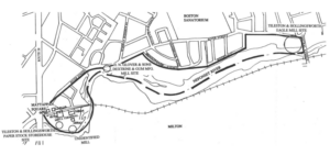
The site later became a station stop on the Old Colony Railroad (OCR) in the 1850s. The OCR line was chartered in 1844 and authorized to build from South Boston to Plymouth. Under the OCR, the Milton Branch Railroad’s final stop was at Mattapan Station, which opened in 1856 (see 1882 map below).
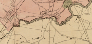
1882 Boston Area Ward Map Sampson– Illustrates Mattapan Station as the last stop of the Milton Branch Railroad, displaying its non-traditional route through the Cedar Grove Cemetery.
By the 1890s, the Old Colony Rail reached the tip of Cape Cod and connected with the northern New England trunk lines, the Boston and Lowell, the Fitchburg, and the Boston and Albany lines.
In 1893, the Consolidated Railroad leased the Old Colony lines, incorporating them into a larger rail system under the New York, New Haven and Hartford Railroad. Until the late 1920s, passengers for Dorchester and Mattapan would have gotten off at the last stop in Andrew, relying on streetcars to bridge the remaining distance to their south Boston neighborhoods.
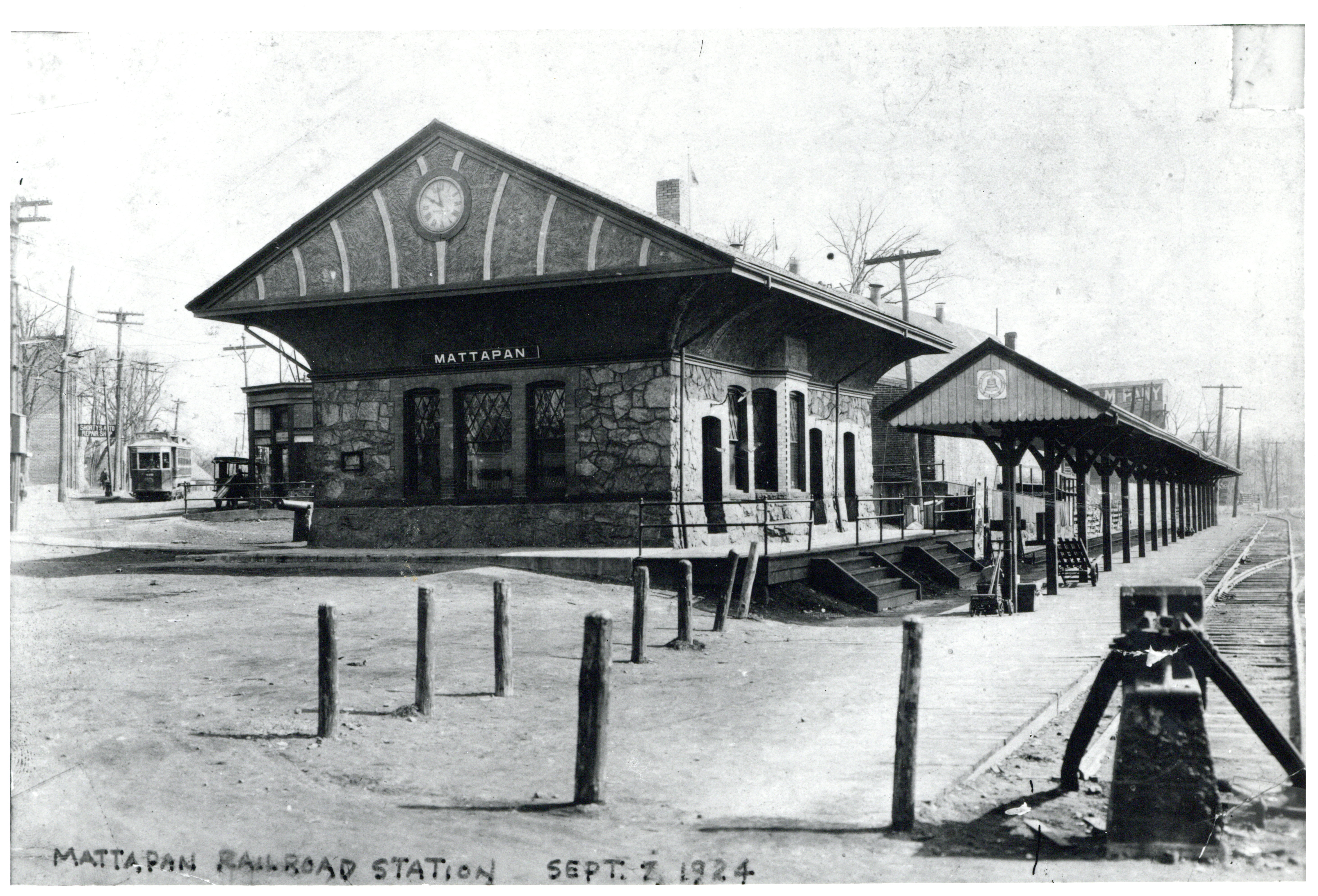
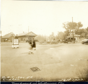
The Mattapan Square station that you see today was originally the terminus of a freight railroad line that was redeveloped by Boston Elevated Railway in 1929 as a high-speed trolley terminal from Ashmont.
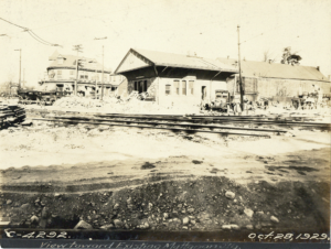
This terminal included three buildings: the passenger shelter (1929), the operator’s lobby (1939), and the yard building (mid-20th c.). The original operator’s lobby at 1672 Blue Hill Ave. was one of the oldest structures, built in 1895 and in use until a new lobby was built closer to the track in 1939. That 1895 building was sold in the 1950s and briefly became a Papa Gino’s in the 1980s. Today that building is a Haitian restaurant, Kuizinn Lakay Plus. 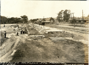
HBI was on-site to assess the state of what we had initially thought was the yard building (mid-20th c.) for any potential new use. Though we are having trouble locating their source materials, one article suggested that the building in question was a 1913 comfort station. This suggestion holds weight as the architecture of this building by the Neponset aligns with the style of other comfort stations built throughout Boston in that era. 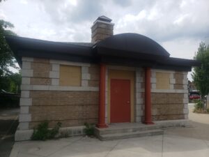
The station’s history as a mill is thanks to its location on the Neponset River. The Neponset provided the means for the first paper and chocolate mills in the US, though little to nothing remains of those historic mill buildings. The Walter Baker Chocolate Mills once operated a few miles upstream of the station, and thankfully, one of those mill buildings was preserved and adapted into apartments.
At Mattapan station, a new housing development just wrapped; The Loop at Mattapan station redeveloped 2.57 acres of MBTA parking lot into 135 units of affordable, mixed-use housing and 10,000 square feet of retail space on the first floor. With the non-profit grocery chain Daily Table as the first commercial tenant, new occupants will have access to healthy and affordable food, free use of the 2.4 mi. long Neponset River Greenway, and of course, will be in proximity to vital transportation services at Mattapan station. These developments are long over-due as Mattapan residents have been under-serviced for decades. It was only in 2019 that the MBTA finally built two stops along the Commuter Rail’s Fairmont line in Mattapan: one at Blue Hill Ave and one at Morton Street.
The Neponset itself is in flux as the Neponset River Watershed Association begins its River Restore Project. This project aims to restore the free-flowing water of our riverways by removing man-made dams to get the Neponset and others back to the ecological balance exhibited when the native Pokanoket Wampanoag were the stewards of this river.
After we got a look at this unique space, full of preservation possibility and reuse potential, HBI is wondering what else might the folks of Mattapan Square like to see in their neighborhood.
Photos courtesy of Digital Commonwealth
Maps courtesy of MACRIS